Sailing the Baja Peninsula
This post is late and that’s intentional. It’s taken me a while to collect my thoughts on the 800 nautical miles (NMs) we traveled down the Baja coast, passing through the states of Baja California and Baja California Sur in Mexico.
This felt like a big step in a couple of ways. We had to enter Mexico. We would be passing along a sparsely inhabited coastline. We would be going down the whole thing with just the five of us. We still had to keep school moving.
None of these challenges were insurmountable - many have traveled this section of coast both southbound and northbound. But for us, these all added up to a sense that we were headed into our next chapter.
We broke this chapter up into 4 sections:
San Diego - Ensenada: 67 NMs, 10 hours and 47 minutes moving time
Ensenada - Bahía Tortuga: 291 NMs, 48 hours and 24 minutes moving time
Bahía Tortuga - Man of War Cove, Bahía Magdalena: 261 NMs, 45 hours and 32 minutes moving time
Bahía Magdalena - Puerto Los Cabos, San José del Cabo: 184 NMs, 30 hours and 4 minutes of moving time

On overview map of the Baja Peninsula, with the approximate distances labeled. Our actual distances were a bit longer based on sailing.
We left San Diego on the 14th of November and arrived in San José del Cabo on the 3rd of December, so about 20 days of elapsed time.
Rather than recount step-by-step, I’m going to pick some moments or themes from the time. Numerous cruising guides cover this coast well and those are well worth reading if you plan to do it. They don’t always agree, which means they provide some helpfully different perspectives. Charlie’s Charts and Mexico Boating Guide are the two we primarily used.

When possible, we stocked up on a fresh veggies and used our “kitchen hammock” to hold them
Ensenada

Ensenda welcomes you with a giant Mexican flag
The trip south was easy and uneventful. After a whirlwind of preparations, we dropped the lines at 0530 in calm conditions. By 0800 we had crossed the border and spotted the infamous bull fight arena on shore. We had light winds, so we motor sailed the whole way, remarking on how the coast line rapidly got less and less developed as we headed south. We arrived in Ensenada and were on the dock at 1622.
We stayed at the ECV Cruseport Marina. It was a good place to get settled. The staff were incredibly helpful in getting cleared into the country, including accompanying us to the Port Captain’s office and helping through the many steps. It is centrally located just south of the downtown area.
It took us a while to get our bearings on the town, but slowly we discovered great restaurants and some parks. One thing I had to understand is that there is less zoning that I had grown accustomed to - you might find a great place to eat tucked into what looks like a residential neighborhood blocks away from the main drag. Recommendations from locals or people who have spent time there are invaluable. There was a great cruising community in the marina that was an invaluable source of information, along with the folks who ran the marina.

A map of the mission we found in the history museum
Bahía Tortuga (aka Turtle Bay)
After a week in Ensenada, it was time to make the run down the rugged Baja peninsula.
The final step before leaving was to fill up on diesel, for which we had to go to Marina Coral a few miles back north on the top side of the bight in which Ensenada sits. Fuel is a topic of much discussion, even on sailboats. There are not many places to fill up on the way south till you reach the bottom of Baja. Boat fuel consumption is a bit complicated because you consume by hour running, not by “speed” as speed is influenced by a wider variety of factors. 600-700 nautical miles, is about the max range we have if we had to motor the whole way. Fortunately, there are ways to extend this. Motor slower and motor sail (which reduces the load on the engine and therefore reduces consumption). We consume between 1 and 2 gallons of diesel an hour with the main engine, depending upon the speed at which we run the engine. We go between 5 and 6.5 knots (nautical miles per hour) while consuming that diesel.
Given all of that, to be safe, we had picked up two jerry cans (5 gallon tanks that you can pickup with your hand) to hold just a few spare gallons in reserve. We filled up the main tank and then filled up the two jerry cans on deck. After a few minutes, we noted a strong diesel smell. It turns out that one of the brand new cans had a leak in the bottom and was slowly dripping diesel onto the deck. In our haste to clean it up, someone ran around with socks on that got soaked in diesel and tracked into below into the cabin in the desperate run for cleaning supplies. Suffice it to say, it took a long time to fully rid ourselves of that diesel.
This is an extraordinary about of detail about filling up. However, it seems like a common occurrence. The last fuel stop before a passage leads to some sort of scramble, just when you need to go. At least we didn’t put gas in the diesel tank or diesel in the water tank.
The time pressure in this case was that we had a window to get to Turtle Bay before a “Norther” on the other side of Baja blew strong winds across. Strong enough winds that you wouldn’t want to be out in them if you could avoid it. Our arrival timing put us in just as the wind started to come across. It’s worth noting just how far weather forecasting has come. We had, what turned out to be, a highly accurate weather forecast 3 days beforehand. We had to get there before this wind came in, without burning too much diesel as we needed to plan as if there would be no more chances to get diesel.

A wind map of the Norther we experienced

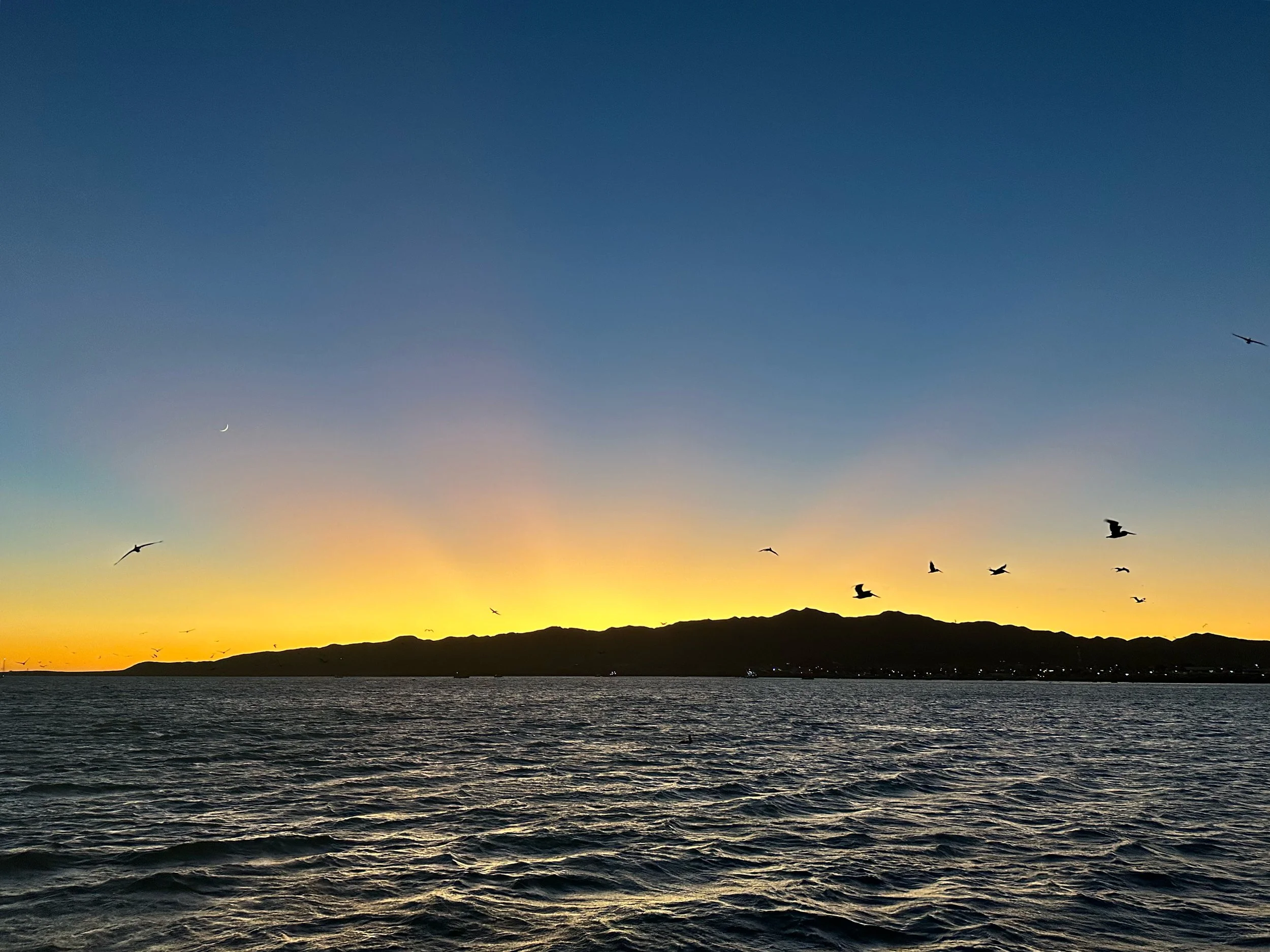
Nighttime sailing
Our watch schedule was pretty simple - 3 hours on, 3 hours off, with Luke taking a dedicated swing shift from 1700 to 1800. The kids could join us anytime they wanted to at night. The nights are long this time of year but the kids joining and repeated dolphin visits helped pass them by.
The wind was close astern so we had to carefully watch our downwind angles and maximize speed. In reading the log, many of the entries are about adjustment to sail plan or course to maximize speed.
The most exciting part for me was passing between Isla de Cedros and Isla de San Benito. It was the middle of the night and there are numerous reports of breaking waves off of Cedros in certain sea conditions. We had no moon, so it was really impossible to see anything ahead. The wind was relatively calm through the start of the pass but built as we headed south it grew and was nearing 20 knots, compressing and accelerating around the bottom of Cedros. I read and re-read the various guide books to ensure I had set the course to avoid the hazards. It was so dark all I could see of Cedros was an area without stars in the sky. But with the sails set we flew on this accelerated wind and a large pod of dolphins swam with us for hours, suggesting to me that we were on the right course.
The final miles into Turtle Bay were slow as we slammed into a north setting current. Speeds on sailboats are slow - so we went from flying at 7 knots to crawling at 5 knots. But we made it - and we made it just as the Norther started to pour across Baja. For the next two days we were pinned in the boat with 25-30 knot winds blowing, picking up ochre red dust and covering the boat. We had the hatches all closed. In made the overall passage feel like 4 nights - with the last two watching the wind just relentlessly blow. We tucked in close to the northeastern short of Turtle Bay so the seas wouldn’t have any distance to build.
You can see the dust in the air. We had 200 feet of heavy chain out and the wind was strong enough to lift most of it off the sea floor.

Mamie made an apple galette and a pumpkin pie!
Thanksgiving was celebrated on the 26th. We made a feast and missed family. It felt like we were in the middle of nowhere - Mamie dubbed it “a lake on Mars” given the arid, red landscape the surrounded us on shore. We enjoyed spending the holiday together, even if it was a day late. Everyone joined in making the meal and we were able to call and video chat with family members.
It was funny to have travelled so far only to be pinned in the boat. Everyone was a little bit restless, but also tired from the passage and the days preparing for it. It’s always a mixture of feelings. You want to catch up on sleep, but you also want to get ashore and explore. In this case, the decision was made for us. The wind howled and we stayed below, watching the birds surf on the gusts and enjoying the time together.

We hiked up to the top of the hills on the northeast shoreline, getting a great view of the whole harbor
After the wind abated, we set off and explored the secluded beach on the northeast side of the bay and eventually made it to town. The rugged beauty of the beach and the hills beside it were enthralling. The wildlife in the bay was remarkable, with huge amounts of pelicans and sea lions chasing the fisherman who worked the bay.
Pelicans (and sea lions) swarming the fisherman as they pulled in their net
Bahía de Magdalena

Squid on deck, found in the morning after a night at sea
This is the largest bay south of San Francisco Bay on the west coast. It’s an incredible place filled with sea life, beautiful hilly shorelines, and miles and miles of white sand beaches (covered in incredible shells!). The trip from Turtle Bay had been bouncy and, given the shape of the coastline, we went way offshore. It’s a straight shot south and we had some gorgeous sailing, dolphins, and decks littered with small squids every morning. We sailed much off the way and enjoyed some truly beautiful days and nights.
The town just onshore in Man of War Cove has only a few houses and a number of finishing pangas on the beach. We spent most of our time on the beach north of this. With no development, mangroves behind it, and a large vibrant bay, it was gorgeous. The beach was littered with shells we had never seen before. The weather was perfect for post-school beach exploration sessions.

Looking west from the beach in Mag Bay - those hills are on the islands that enclose the bay
I discovered some of our zincs - anodes that protect the metal equipment on the boat had either fallen off or completely eroded away. The clear water of the bay was a perfect place to inspect the hull and check on these things. I had spares aboard and once again wished I knew SCUBA. Instead, I used my trusty snorkel mask and replaced the ones I could. It took quite some time as the last thing I wanted to do was drop the new ones - or the screws needed to affix them - to the bottom!
We planned to spend a bit more time, but one night our generator failed to start. This, it turns out, would be the start of a long saga. As of this writing, we still do not have a clear date when it will be repaired. The generator is used to make electricity to run the various systems on the boat when the engine is not on. It also charges the batteries. When we are at anchor, we typically run it a bit each day to charge up the batteries. It is not a “critical” system as we can also make electricity with the main propulsion engine, but this is not optimal.
Getting stuff fixed is hard at home and bit more challenging when you are constantly on the move. We decided to press on to Los Cabos to get some help with the generator.
Los Cabos
The “shortest” of the legs, we did this passage in two days and one nights - whereas the previous two had been 3 days and 2 nights. Generally we had light winds and motor sailed much of the way. Through the miracle of modern technology, we were even able to watch a friends Bar Mitzvah while underway. It’s kind of stunning to reflect on how connected we can be.
We also passed by the Tropic of Cancer, “the most northerly circle of latitude on Earth at which the Sun can be directly overhead.” I honestly never thought I would ever cross that on a sailboat. Seattle is at ~47.6 degrees North latitude. We were now sailing past ~23.2 degrees North latitude. (Interesting fact - it, of course, moves a bit every year. It is not a fixed latitude. Read the Wikipedia article linked above to learn more!)

Charging south
Rounding Cabo San Lucas (Cape St. Luke!) felt like the close of another big chapter. We look a “left” and head south just outside of the Strait of Juan de Fuca in August. 2,200 nautical miles and 3 months later later we look another “left” at the bottom of the continuous coastline we had sailed down.

Sailing past Cabo San Lucas under Geneker alone - we can do 6-8 knots with this sail alone, in a wide variety of wind conditions
We were struck at the amount of onshore development after 700 nautical miles of very little. There was a profusion of tour boats and fishing boats. We opted to head a bit past Cabo San Lucas to the harbor of Puerto Los Cabos just outside the town of San José del Cabo.
Overall
The Baja Peninsula is quite a stretch. We just scratched the surface, but felt like we got exposed to a whole new part of the world. We ended up with plenty of fuel. We ended up being able to plan the passages well for weather. We ended up navigating safely. All of these concerns were real, but the fears weren’t realized. Yes something broke (the generator) but we made do. The rugged, desolate beauty and the sea filled with life was magical to travel through. I can’t imagine sailing north along it, as some do, but sailing south leaves quite an impression.