
Bahía Concepción
A couple of hundred miles from La Paz lies a bay clinging to the side of the Baja peninsula called Bahía Concepción. It’s reasonably long but narrow enough that you can always see both sides. It’s entered from the north and shaped like the gap between an open thumb and pointer finger.
Despite its size, it isn’t all that well charted and doesn’t have that many marked anchorages. Most of the places to stay are located about 9 nautical miles south of the entrace in a scallop on the peninsula side called Bahía Coyote.
We poked around and explored much of the bay. We spent time in Domingo near the top, in the anchorages of Playas Santispac, Burro, and Santa Barbara in Bahia Coyote, and made a day excursion to the southern end to explore some rock paintings.
Our C-MAP and Navionics charts were essentially useless. The small charts focused on Coyote and Domingo from Sea of Cortez; A Crusier's Guidebook were useful for those spots, but to explore further afield we had to find other sources. Captain Pat Rains’ Mexico Boating Guide lists a number of spots to stop in the southern portions of the bay but does not have any charts. The best resource for some sense of depths throughout the bay came from a PhD thesis entitled Wind and tidal response of a semi-enclosed bay, Bahía Concepción, Baja California by Aurélien L. S. Ponte.

During our time here, there weren’t any big weather systems, so we mostly experienced the daily thermally created wind cycles. Hot sun and a dry landscape create breezes that cycle around the compass dial over the course of the day. The wind almost swirled around the bay, taking the air off the land, over the water, back onto the land, back over the water - all of which had the impact of heating the air. It felt like a blow dryer most days with winds in the teens in the afternoon with an air temp in the low 90s. It also created the odd experience of having the wind change direction within the bay - one day we sailed from a southern stop with the wind on our back until we were halfway up, and then the wind backed to being almost right on our nose with equal intensity. Early morning hours were typically calm with the wind filling in as the sun rose and heated the atmosphere.
Wind forecast for Bahia Concepcion from the HRRR weather model for Sunday, May 28th at 8 AM to Tuesday, May 30th at 5 AM. The wind barbs represent direction (where it is blowing from) and speed (based on number of marks on the end). Colors also represent speed - blue = calm, green / yellow = starting to get windy, red = windy
Within the bay we spent time in a number of anchorages.
Domingo
Domingo at dusk
At the top of the bay lies a shallow anchorage set against the mountains that create the eastern side of the bay. We enjoyed our time here. Good wind protection from the afternoon easterlies and beautiful backdrops in all directions. The shore is undeveloped and the beach is full of cool shells. The water temperature here was 78 degrees in May, about 5 degrees cooler than further in the bay.

Looking east from Domingo in the afternoon
Santispac
Set in the northern portion of the Bahía Coyote scallop, this place provides great wave protection from any north, east, or western winds. The downside is that it is Baja California Trans Peninsula Highway - or Mexico Highway 1 - backs the beach. This is the main route along which all road traffic (cars and big trucks) ply the Baja. The engine noises are jarring in this otherwise tranquil setting. Water temps were in the low 80s.
Burro

The highway also wraps around this anchorage, but the onshore Nomádico Coffee is a wonderful place to while away a hot afternoon with good food and great atmosphere.
Coyote

Looking south along the beach in Coyote
Within in this Bahía Coyote scallop, there is also a beach / anchorage named Coyote. Lots of Coyotes — off shore there is Isla Coyote that was fun to explore via snorkel gear and dinghy. There is a small tienda with just the bare essentials across the highway on the northern corner.
Santa Barbara

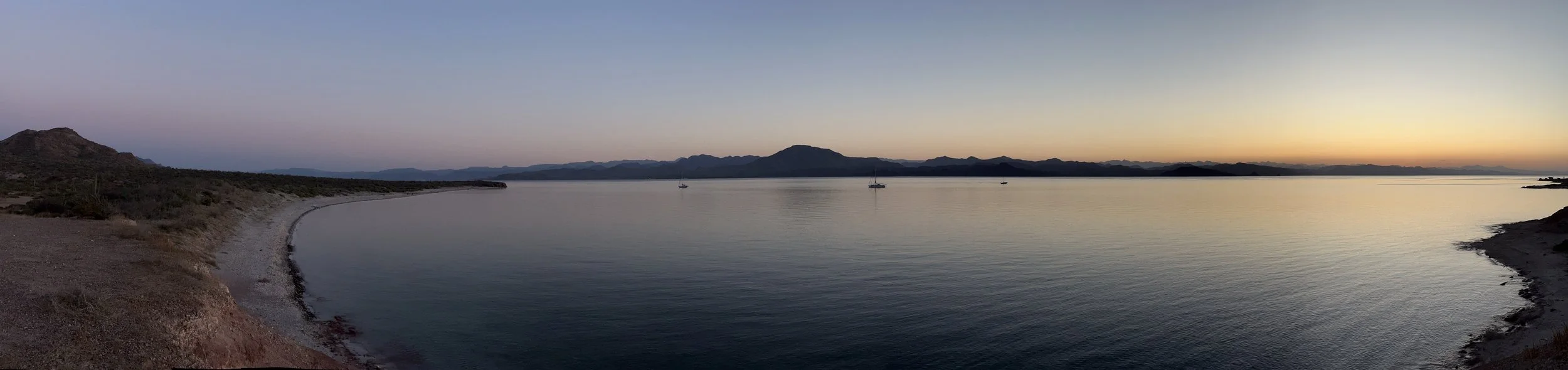
Panorama from the southeastern corner of the anchorage, near the mangroves
By far and away our favorite overnight anchorage, Santa Barabara is at the southern end of Coyote and much more rural. There are a couple of fancy tents ashore, but those were unoccupied (and appeared abandoned). The highway is behind a couple of hills and no longer along the shore at this point and the afternoon thermals were typically from the southeast for which this playa had good protection.
There was a nice waterside fringe of green - mangroves and tall cacti dotted the shoreside landscape, providing some welcome new colors in an otherwise rock and mineral dominated landscape.
The water clarity wasn’t great, but in the shallows we spotted a lot of rays, including three big eagle rays. On the point that forms the eastern edge of the by there is an easy hike out a dirt road to good views of the whole area.


Southern Reaches
Our biggest exploration was to head south for a day hike into the arroyos on the eastern side of the bay. With the simple bathymetry map in hand we eased our way south and found sufficient depth the whole way. We anchored off an arroyo exit and followed it inland. We were treated to a beautiful canyon that was filled with rock paintings. We are all enthralled by these. We’ve seen reports that these are 6,000 - 7,000 years old, but not seen any scholarly work on the subject.


Overall
Despite the heat (and we know it gets hotter!) we enjoyed the daily explorations in the bay. We didn’t even really touch upon the islands that we explored by dink and by snorkel, but that’s perhaps the point. There is so much here that it’s well worth taking the time to soak it all in.