
Bahìa de Chamela
In about 18 hours, we traveled 99 nautical miles and felt a world away from La Cruz. We were excited to be out again in a more rural setting.
The trip south from La Cruz is pretty straight forward - you head southwest, round Cabo Corrientes, and then make a turn for the southeast following the coastline. The only tricky part is rounding Cabo Corrientes. This cape (aka cabo) is yet another one of these “bumps” along the coast where wind gets compressed and accelerates. This one has a strong north setting current close to shore which creates steep, short waves in strong northerly winds. (Confusing, but convention dictates that current is described by where it is going and wind is described by where it is coming from!) One could describe the journey from Seattle as a series of cape roundings – Flattery, Arago, Blanco, Mendocino, Arena, Sur, Conception, Eugenia, San Lázaro, San Lucas, Pulmo, Mita – each of which creates its own weather and requires respect when planning to pass. The whole Pacific coastline looks pretty straight until you zoom in and travel along it at whim of wind and waves.


We left the harbor around 6 PM due to a “reversed flow” around the cape in the heat of the day. In this case, reversed means the wind blew from the south and rounded the cape heading northeast. This created choppy conditions as it blew across the bay. Several boats left earlier in the day and got stopped by the short, choppy seas that came up. We were glad we waited for it to start dying, but even when we came out at 6 PM the seas were bumpy and we slammed into the waves for a bit. The winds had come around to be more northwesterly, so we immediately raised sail and headed southeast.
The wind slowly died as we neared midnight but kept up enough to keep sailing. We had a set of boats heading north rounding the cape that we had to negotiate passing sides with on the radio. It’s pretty fun to track the boats, figure out what heading they are going in, and then figure out how to safely pass while still maintaining our general course.
Even with low wind speeds the cape was “lumpy”. This is not a technical term but refers to a sea state when the waves seem to be bouncing around from all directions. It’s like being in a bathtub with the water sloshing all around.
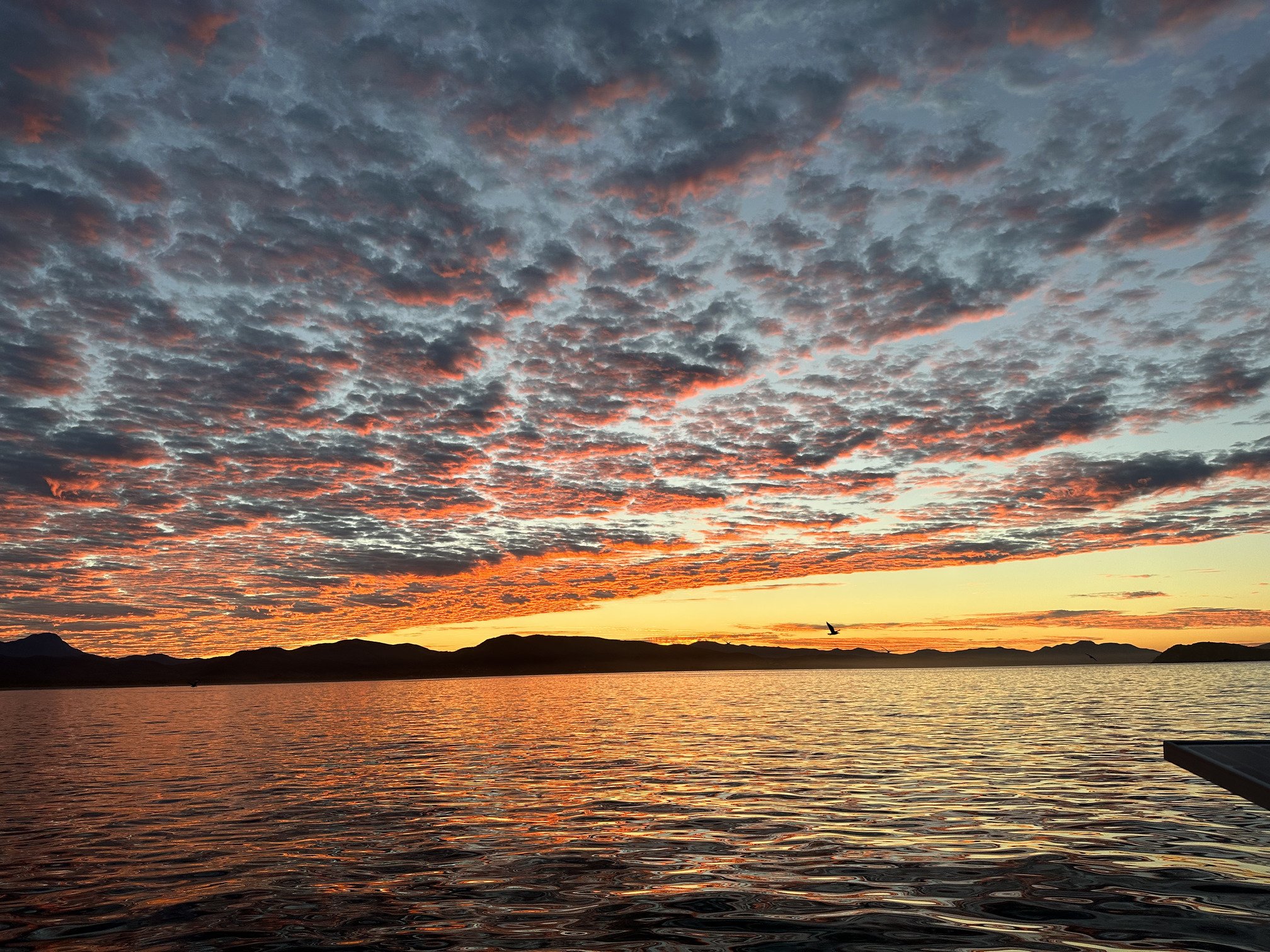
The wind came on beautiful as we headed to morning. We had a great sail in the morning down to Chamela. The sunrise over the coast was glorious. We split the watch overnight, trading off every 3 hours. The 0600 - 0900 watch is highlight of the day because I get to see the sunrise.

Sailing along as the sun rises
When we came into Chamela, we headed to the northern anchorage, tucked in the lee of the northern hook that forms the bay. This was an attempt to get out of the waves. It sort of worked.
Waves are complex. The come from many directions and meet up in all sorts of ways. I truly did not have an appreciation for ocean waves until this trip. The waves at any particular location are made up of many other waves created in other places. Waves are created by wind blowing over water, but long after the wind dies or changes, those waves march on. And those various wave trains meet up in a variety of ways all over the place.

Here is an example of a wave forecast produced by the European forecasting model, published by PredictWind. This is an example of a very calm moment with 1 meter waves created by 4 different sources - the wind at the location plus 3 swells that came from other places.
You can’t really escape these swells - they wrap around points, they slide through breakwaters, bounce off of the shore - and we felt all of this in Chamela. The first day was quite calm, but by the next day, the 2 meter waves just outside the point were wrapping around and marching into the anchorage and onto shore. It quite something it watch as a 6 foot+ swell roll through an anchorage. The boat goes up and then back down - and you watch the hulls of your neighbors disappear and then re-appear. If you are head on into these swells the motion isn’t bad, but if the wind has you pointed perpendicular to the waves, you sort of roll over them back-and-forth like the hand of a grandfather clock.
We enjoyed the tranquil setting with very little development in the hills around. Boats came and went and we met several other kid boats while there.

Anchorage at Punta Pérula
We also headed in the small channel in the corner of the harbor after the waves died down. It’s a shallow entrance used by pangas taking people back-and-forth to the islands in the middle of the bay. The town has several beachside palapa restaurants and a main square with a stable of businesses. I couldn’t help but enjoy the wall art at this Internet cafe.

I recognize this logo, trying to place it …

The large, open, white sand beach at Punta Pérula
After a full week of school on board, we took a dinghy excursion to the islands 2 miles south of us in the bay. There is no development on them and they have some beautiful little beaches and supposedly good snorkeling. All the swells and churned up the water, so we didn’t get in the water, but we did enjoy the beautiful sights on land. The contrasts between all of this water and the rather arid islands, covered in cactus, made for beautiful sights.


We enjoyed the week here, but the rolly nights added up. It was time to head south to Tenacatita and see what all the hubbub was about. But one last sunrise left us with a warm glow.
Sunrise