
Channel Islands! Part Deux
Unlike the sequel to Hot Shots, this Part Deux was a big success. When we arrived at Channel Islands Harbor we knew that we needed some calm water, but we hadn’t decided if it was time to head south yet.
Channel Islands Harbor, next to / a part of Oxnard, is a pleasant place to pass some time. The public docks were readily available and the fellow cruisers on it made for pleasant company. Having a Spudnuts donuts just down the block didn’t hurt. This is a large man-made harbor with a lot of boats and an extensive canal system lined with houses. We enjoyed exploring the nocks and crannies by dink. The sand is constantly trying to revert the harbor to nature. A multi-year dredging operation is running 24 hours a day in the middle of the entrance channel (run by a Seattle-based construction firm!), pumping sand a mile south through a giant pipe laid across the beach. The giant barge has to move to let you in or out of the harbor – a rather nerve-wracking maneuver in the narrow channel.

Just look at this enormous drier in action. And on $0.25 for 8 minutes.
A note on laundry. One of the often underreported aspects of extended cruising is the search for laundromats. Better than donuts was the close proximity of a nice laundromat to our dock. While we are by no means experts, I have come to determine the best ones have large, high-volume washers and driers. Typically this means an extended trek through town, carrying all of your laundry in some sort of cart. Marina washing machines are often small, expensive and unreliable. Nothing is worse than doing a load to find they come out dirtier then when you started. A large laundromat machine is a thing of beauty. And you get to meet folks while folding. (The walk back with folded laundry is often worse because you are desperately trying to maintain all of that folding work during transport.)
Right next door to the harbor lies Port Hueneme (why-ne-me). This is the only deep-water port between Los Angeles and San Francisco – and in the case of the Navy, the only Navy controlled port between San Diego and Puget Sound. We heard reveille each morning. This port is also a commercial port with acres of new cars parked after being delivered off ships.
After watching a miraculous Mariner’s playoff game, we plotted our return to Santa Cruz Island. We wanted to make it to Painted Cave on the northwest side of the island. We found a patch of relatively settled weather (moderate west to northwest winds & seas) and headed out after school on Monday. We spent our first evening anchored in Little Scorpion, getting some protection from the breeze and swell before departing early in the morning for Cueva Valdez and Painted Cave.

Eventide enjoying Little Scorpion for the second time.
Why all this fuss about Painted Cave? Well, it’s the largest sea save in North America by some accounts. It has a large entrance and extends some 600 feet back into inky black darkness and has sea lions resting at the terminus. The “paint” comes from the various algae, fungus, and plants growing on the walls. You can’t anchor at it, so your choices are to take your boat and standby offshore while a party goes in or to anchor nearby and head on over by dink. We chose the later.
Cueva Valdez is a picturesque bight about 3 miles east of the cave. It also has a sea cave , with three separate entrances, along with a gorgeous valley and mountain backdrop.

Eventide anchored at Cueva Valdez.
By this point a couple of check boxes had been ticked. We had anchored with plenty of room and set the anchor well. We had gone to 4 to 1 scope and watched for a bit to make sure we had a solid hold. The wind was pretty light but was blowing us towards a lee shore. Given that we were the only ones in the anchorage, and we would be heading out for a few hours, I wanted to make sure we would find the boat where we left it. Now we just needed to get ready, load up the dink, and hang on for a ~3 nautical mile ride further west.
The cave was worth it. All these steps and planning were justified. The entrance is huge. And immediately upon entering you hear the sea lions call from the back. The cave gets lower and lower as you go further back. The surge comes in and raises the water up and down. At the end of the visible cave, there is a chamber to the right where most of the sea lions are. It’s an other worldly experience.
I brought a 360 degree camera with us. I will be the first to admit that there is nothing worse than poorly edited home movies, so I apologize in advance. I tried to pick the interesting things we saw. Despite the roar of the sea lions, you can probably also here our banter. Consider yourself warned and feel free to skip past these!
The walls are multi-colors and there are big ledges up on either side. The sea lions would swim back and forth underneath the dink as the entered or exited the cave. The cave got darker and darker till at the very end, there was just the faint hint of daylight.
The back chamber is dark, and once your round the corner you can see the eyes of the sea lions reflecting in your light and the daylight streaming in from the passage you just went down.

The view back out the cave after rounding the corner in the back “room”.
In case you didn’t get enough of the cave, I uploaded the full 360 video so you can actually pan around and see any angle. Here is the 360 degree video of the entrance. And here is the 360 degree video of the interior.
The return to Cueva Valdez was easy and we enjoyed the crazy geology along the way. As I talked about in the last post, these islands are young. There were created by a combination of plate compression and underwater volcanism. This means there is incredible mix of shapes and rock types. There are blow holes dotting the coast. It feels raw and rugged. With no one else around that day, it felt like we had stepped back a few million years.
The forecast for the evening held such that we could spend the night at Cueva Valdez. The winds from the northwest would peak around 12 knots and then start to die overnight. Enough of the models agreed with this that we felt comfortable that we could spend the night without having to worry too much about the lee shore or a swell building up. It was a fun afternoon exploring this landscape. We spent some time snorkeling and hiking ashore.


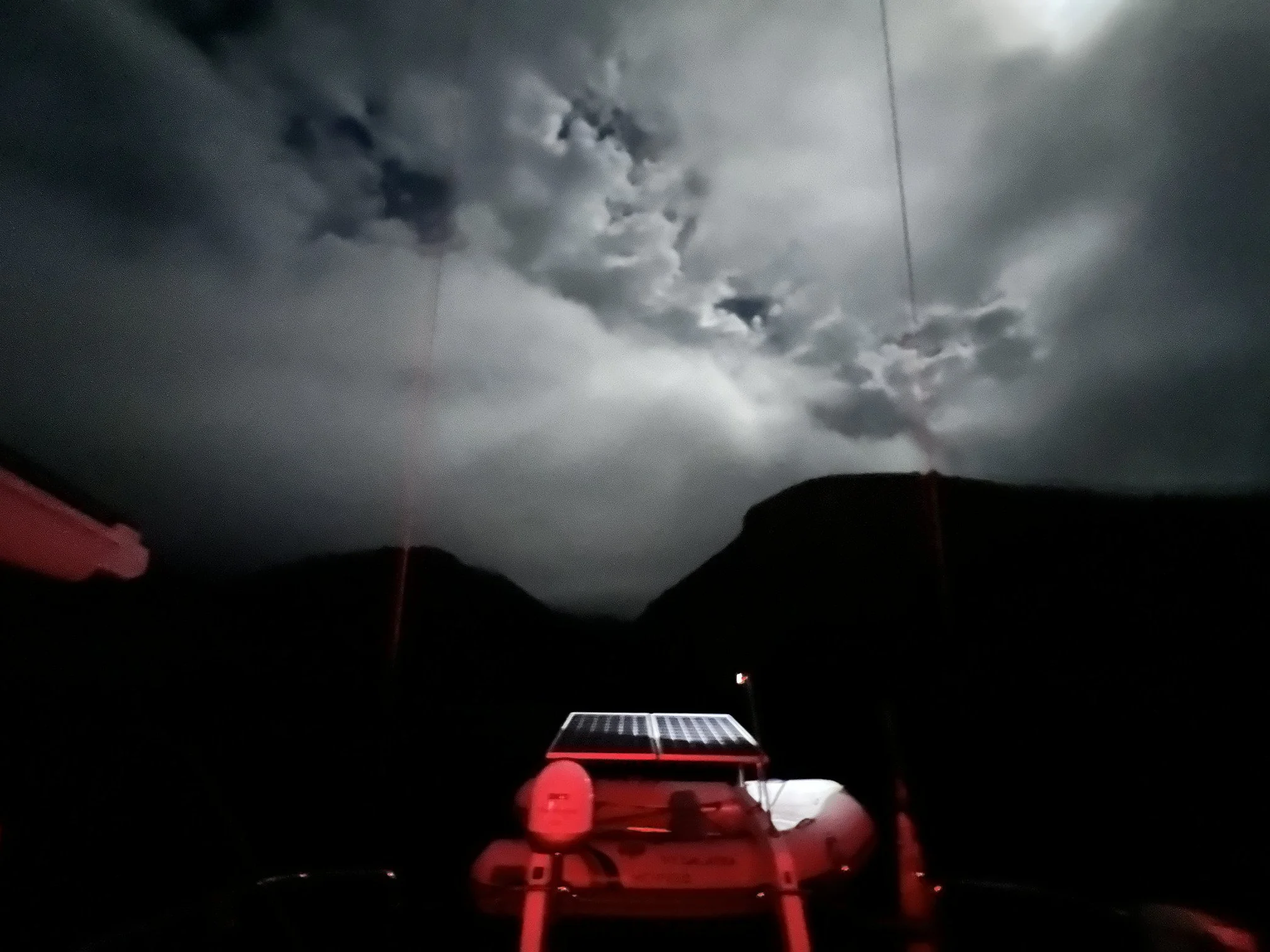
Radar from half an hour before the rain and wind reached us.
The wind abated as the evening wore on as expected, but the slight chance of thunderstorms turned into actual thunderstorms. Nothing too big but lightening at sea is always a bit nerve wracking. And the gusts that can be associated thunderstorms typically change wind angle by 60 to 90 degrees from where it was blowing before. This means that an anchor that was well set can all of the sudden break free due to the sudden angle change and strong push from the wind. True to form, when storm passed over us, it was accompanied by dramatic down drafts out the valley we were anchored in front of. All of the sudden it went for a few knots from the northwest to 20 knots from the south for a few minutes. Fortunately, this was a pretty isolated set and the rest of the evening was uneventful.
We had accomplished our stated goal for Part Deux, so it was time to move on. The weather looked good for a trip down to Catalina Island so we set our clocks for an early start and shoved off by 515. A dark start, but required to make sure we arrived on Catalina before dark - it is October after all, so the days are getting shorter.
One last look at Cueva Valdez before lifting the anchor. The moon was out, coming in and out of the clouds.
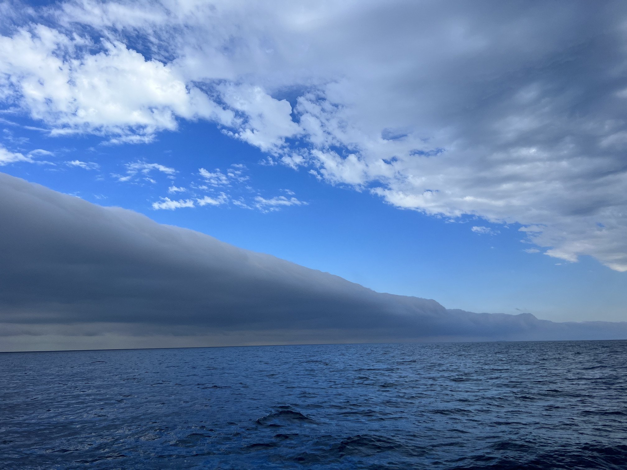
The morning was cloudy as the atmosphere was still unsettled. Air from inland was being pushed out to sea and this was creating the thunderstorms (also known as squalls) we had experienced the night before. It was odd to me to have weather “coming” from the east when most of the time it comes from the west in the Pacific Northwest.
We knew a chance of squalls (I’m using this term now that we were underway) persisted throughout the LA basin. We watched the radar as we headed east along Santa Cruz Island, before taking a right and slipping between it and Anacapa Island for a straight shot to Catalina. As a side note, it is interesting just how big Santa Cruz is. It is four times the size of Manhattan and bigger than Washington, DC. It took us a few hours to motor in the light morning breeze down its length.

The sun is always a welcome sight in the morning. This is looking east past the end of Santa Cruz Island. Anacapa Island is in the distance.
The squalls looked manageable as we passed Santa Cruz, so we made the turn and headed to Catalina. But they did arrive. First, we got the tail side of one and the associated big down draft turned a gentle beam wind into a strong tail wind for about 30 minutes between Anacapa and Santa Cruz. A few hours later, we went from a strong headwind to a strong tail wind after a line passed overhead.

Dramatic clouds over the LA basin.
One of the lines of squalls after it passed over us.

But the moon was a consistent friend through most of the day.

Sailing on a broad reach
After the squalls passed, we were treated to a great broad reach. In 15 to 18 knots of wind we did 6.5 to 7.5 knots and just flew the last 20 nautical miles. This is how hours and miles can just disappear. Throw in a few dolphin visits and some truly phenomenal dolphin leaps and almost any previously choppy seas or gusty winds are forgotten.
The squalls only added to our sense that the Channel Islands are a beautiful, yet temperamental destination. We really enjoyed our time exploring and were thankful to have had the opportunity to pick our weather. This is often one of the challenges in cruising - the best laid plans are only as good as the weather happens to be that day. The chance to go back, based on a weather window, was a real treat.
The sights and sounds of Painted Cave will be with all of us for a long time. The rugged coastline with its intricate rock formations. The underwater sea life and abundance of sea birds. The constant checking of the weather. The triangulation of swells. The question of just how far around the prominent corner, and therefore protected, a particular anchorage is. And yet I know we just scratched the surface.

The northeast coast of Catalina Island