
Channel Islands
After a great week in Santa Barbara, it was time to head out and keep exploring. We left our slip mid-day to catch the fair wind across the Santa Barbara Channel to the Channel Islands. For the entire time we were in Santa Barbara, the winds have been quite consistent, rising mid-day from the west and blowing into the early evening hours. They often die overnight and in Santa Barbara sometimes turn into gentle easterlies overnight.

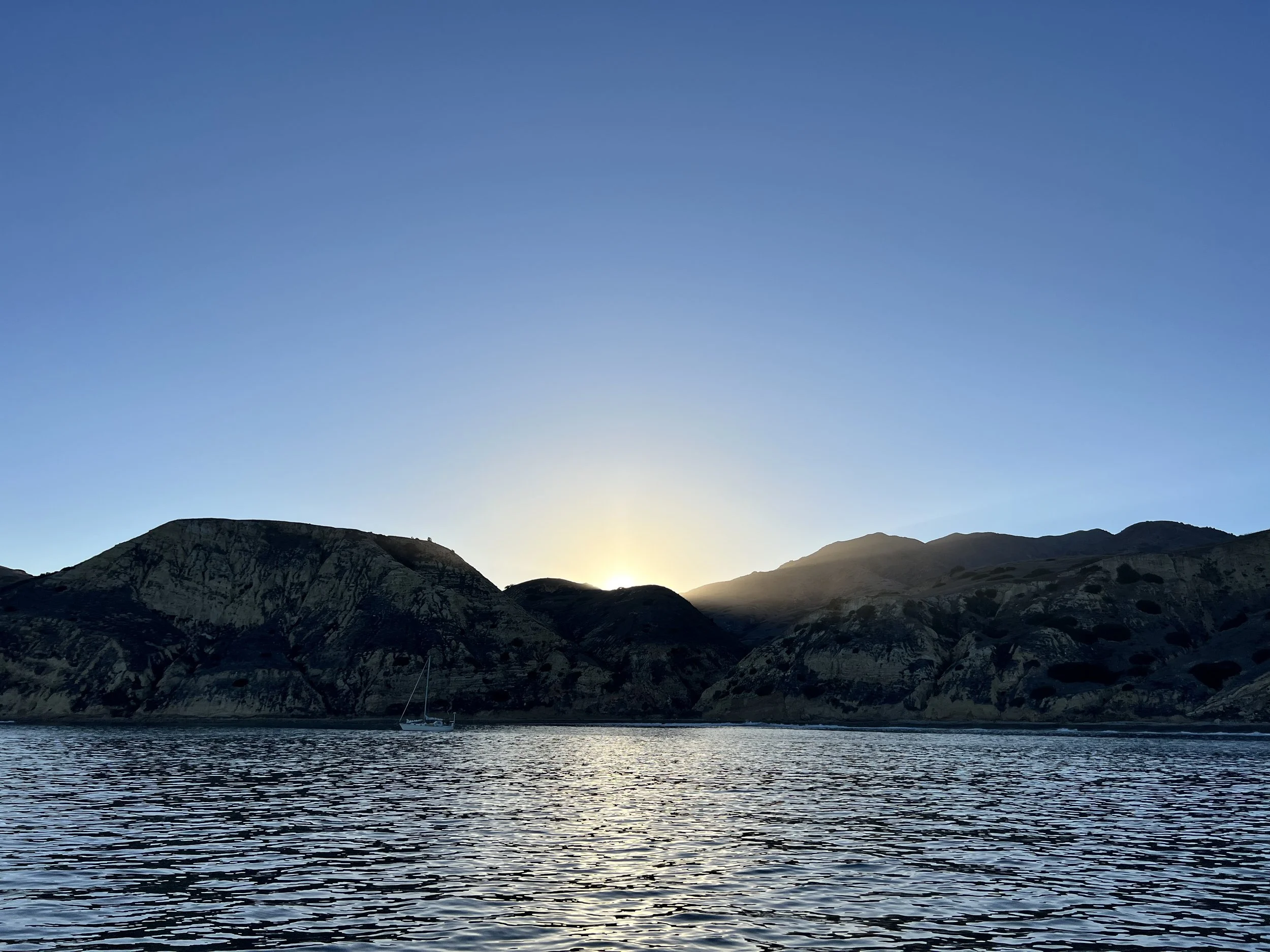
Sailing acros the Santa Barbara Channel
We picked the Channels Islands based on numerous recommendations and a desire to break out of harbors for a while. We are used to spending most of our time at anchor in the Pacific Northwest but the passage south had been largely harbor hopping for us.
It was just under 28 nautical miles across to Santa Cruz Island and we had a great, no tack sail across. The winds were between 12 and 15 knots for most of the sail, accelerating to 17 knots as the westerly breeze got compressed around Santa Cruz Island, which sits largely east-west and acts like a big rock in the wind river.
It is pertinent to share something I’ve learned (or maybe re-learned) in the past few months about the “direction” various elements are reported in. Wind direction is stated in the direction the wind is coming from. A westerly is blowing from the west to the east. When you look west the wind is blowing in your face. A west setting current is headed to the west, meaning is flowing from the east to the west. If you faced west, the current would be pushing at your back. To round it out the various reporting approaches, swells are described like wind - a south swell is coming from the south and heading to the north. In case nautical terminology wasn’t confusing enough, there is always one more nuance.
We had spent the week trying to figure out where to go and what to do. The two books we have to draw from are useful but have somewhat conflicting perspectives. This is, of course, great as it provides different points of view to consider. However, when we took the union of the two sources, every anchorage essentially came with a myriad of caveats. I think, based on our limited experience, this is actually an accurate portrayal of the anchorages on the Santa Cruz and Anacapa Islands.
We spent most of our time on Santa Cruz Island. As Wikipedia puts it “The island’s coastline has steep cliffs, large sea caves, coves, and sandy beaches.” You’ll note “natural harbors” is not included in this list. The tallest peak is 2,400 feet and yet the island is only 22 miles long and between 2 and 6 miles wide. The feeling from the coast is that one is trying to cling onto the side of a mountain.

Our boat at anchor in Little Scorpion, viewed from the trail that leads from the NPS landing site in Scorpion to Smugglers. The island in the background is Anacapa.

Little Scoprion Anchorage as seen from the boat. We took this picture right after anchoring. By the time we made it to shore and hiked up the hills and took the first picture in this post, most of the boats had left.

A sea cave in Little Scorpion, a few hundred yards from where we were anchored
Without going into a ton of geology, it is interesting to learn that the islands are young. They have been pushed up and created by the Pacific plate hitting the North American plate - and were pushed up about 5 million years ago. The northern islands weren’t always distinct - they were in fact one large island during the last ice age. They were created by the same forces that created the mountains behind Santa Barbara. The islands are either sedimentary rock that is eroding away or hard volcanic rock. All this leads to dramatic coastlines.
As we rounded San Pedro Point, the eastern tip of Santa Cruz Island, we turned into the setting sun and started to look for a good anchorage at either Smugglers or Yellowbanks, two named anchorages that are just south. These anchorages are protected from the westerly and northwesterly winds but provide no real protection from south swells.
Over the next couple of days, we spent time in Yellowbanks, Little Scoprion, Scoprion, and Smugglers. The wind was pretty consistently from the west/northwest during the day. On our last night the wind shifted and came a bit from the east, pushing us against a lee shore in Smugglers. The forecast wasn’t for strong winds, so we prepared to pull out if we had to. The wind came late in the night but stayed below 10 knots.
The swell was pretty consistent and the rolling in the boat came and went based on wind and tide cycles. It was worst at high tides, particularly in Smugglers when the swell would hit shore and then send a reflection wave back at us. The shore in Smugglers is a steep, rocky beach - making a dinghy landing impossible in a south swell and providing a perfect reflector for the swell.

Our anchor track during the last day and half we were on Santa Cruz
There wasn’t a great opportunity to use a stern anchor, nor would a riding sail really help given the wind fluctuations. Over the course of our days there we ended up with a mixed bag of rolly conditions at anchor. After setting the anchor, we would float around it based on the combined impact of swell, current, and wind. Spending much of our time floating right over top of it. I know that I have a lot to learn about how to manage swell conditions at anchor and look forward to doing so in the coming months.
Enough about anchoring, overall, we were treated spectacular weather - sunny days, clear nights, and gorgeous sunrises and sunsets.
Sunset at Yellowbanks

Sunrise at Yellowbanks

The Big Dipper setting behind Santa Cruz island from Smugglers

Sunrise over Anacapa Island, as seen from Smugglers on Santa Cruz Island

NPS Visitor Center at Scorpion
Making it ashore was a treat. We took the dink from Little Scorpion and went ashore in Scorpion at the NPS dock. The island was privately held as a ranch and after a messy transition from one generation to the next, ended up broken into parts. This means ranch houses and buildings dot the island. Today, the island has a portion that is run by the NPS and a portion run by the Nature Conservancy (from which you need a permit to land if you are going to the western ~75% of the island).

The hills above the Smugglers Cove ranch
The swell at Smugglers and the steep beach made landing a dink impossible. We made it ashore by anchoring the dinghy just off the breaking waves and swimming ashore. It was an exhilarating experience to say the least. Another former ranch is located just behind the beach, with an olive tree grove on the hill above and gorgeous hiking paths leading to the interior. We saw the local native fox prancing in the dry grassy hillsides and caught glimpses of the dramatic valleys and big peaks in the heart of the island.
Swimming was magnificent. When the swell wasn’t rocking the boat too badly, we enjoyed jumping off and swimming in the warm water. It was definitely warm enough to swim without a wetsuit.
After 3 nights we were ready to find some more settled water for a few nights. We set our sights on Channel Islands Harbor on the mainland, essentially a part of Oxnard, CA. The day was relatively calm, so we took the chance to explore Anacapa Island. It looks, on the days we saw it, like something out of a movie - either Jurassic Park or the planet they find Luke on in the most recent Star Wars movies.
In addition to dolphins greeting us we got to listen to the Navy chase boats out of their live fire exercises. The Navy contacted us on 16 asking us to head 3 miles north to avoid the live fire exercise underway in the LA basin. We promptly replied and agreed to head north, even though we were pretty sure we were out of the closed area. They radioed a few minutes later saying their systems had us 3 miles further south than we actually were, and we were just fine to proceed as we wished.
Other boats didn't reply and were soon treated to Navy helicopters flying overhead and radioing them directly, with chase boats following up and "escorting" them off the range. "Unidentified boat at 34 degrees 8 decimal 20 minutes North and 119 degrees 5 decimal 7 minutes west this is Navy Helicopter Zulu hailing out on Coastal Marine channel 16. We are circling overhead. Do you read?"
After narrowly averting being cannon fodder, we headed to Cathedral Cove for some snorkeling adventure. This isn’t a place you can anchor overnight, but in settled conditions it’s a cool spot to spend a few hours. Everyone donned their wetsuits and life jackets, ready to explore the kelp. It was quite exhilarating and I won’t be able to recap it better than Holden did in his blog post. But I will add a few more pictures that attempt to capture the scale of the place.


In our limited first foray into the Channel Islands, we got to experience quite a bit of what we had read and heard about. They are an interesting set of islands, full of natural wonders that require a fair amount of planning, vigilance, and flexibility to enjoy.